Slovenia's Juliana Trail – what you need to know
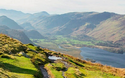
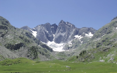
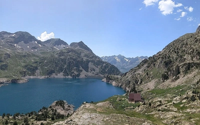
Making a circuit of Triglav, Slovenia's highest peak, the Juliana trek takes in some less familiar valleys along with well-known spots such as Lake Bohinj and Bled. Designed to promote sustainable tourism and reduce overcrowding on Triglav, the Juliana Trail explores a breathtaking historical landscape, rich in wildlife and plants. Read on to discover key information about the trek.
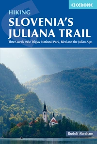
Hiking Slovenia's Juliana Trail
Three-week trek: Triglav National Park, Bled and the Julian Alps
£18.95
Guidebook to walking Slovenia's Juliana Trail, a 20-stage, 330km hike through the Julian Alps circling Mount Triglav. The route is described clockwise from Kranjska Gora with details on public transport, accommodation and available facilities.
More informationEssential Facts
- Country name: Republic of Slovenia (Republika Slovenija)
- Capital: Ljubljana
- Land surface area: 20,273km2
- National parks: Triglav National Park
- Language: Slovene
- Currency: Euro
- Time zone: GMT +1 (CET)
- International dialling code: +386
- Electricity: 220V/50Hz (standard European two-pin plug)

How long is the Juliana Trail?
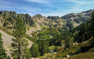
The trail makes a circuit of the country’s highest mountain, Triglav, forming a 270km route around this iconic 2864m peak without climbing it. A further 60km extension branches off to the south. It is formed of 20 stages of between 8 and 22km in length (see below).
Where does Juliana Trail go?
By circling Triglav, the Juliana Trail heads from Kranjska Gora to Jesenice and onto Bled, home to the popular tourist spot Lake Bled. From there, the route passes Tolmin and Bovec before dipping over the border to Italy and Tarvisio. To complete the circle, the Juliana turns east, following a disused railway back to Slovenia and returning to Kranjska Gora.
In addition to a southern extension to Solkan, the guidebook recommends several short detours off the Juliana—to the Peričnik Waterfalls, the Vintgar Gorge, the Savica Waterfall, Tolmin Gorges, Kozjak Waterfall, and the Soča Gorge.
How difficult is Slovenia’s Juliana Trail? Is it waymarked?
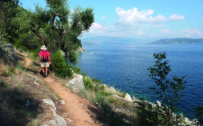
The trail is relatively easy, with no technical sections. The Juliana Trail and recommended excursions in the guidebook follow well-kept, clearly marked trails that require no special equipment or climbing skills.
The Juliana Trail has its own trail markings, generally a yellow sign with the stage end and the Juliana logo, and JA marked on rocks and trees.
How long does it take to walk the trail?
The route takes around 3 weeks to walk and is suitable for beginner and experienced hikers alike.
When is the best time to hike the trail?
Hiking the Juliana should be possible from April to late October, though snow will linger on higher areas and passes until June. The main hiking season runs from May to the beginning of October when most mountain huts close.
There are considerable differences in climatic conditions between different parts of the Julian Alps, partly due to the greater proximity of the Adriatic in the southwest and obvious temperature differences between valley floors and higher ground. The moral of this is to come prepared—start hiking early in the day to avoid any potential afternoon storms, and always carry suitably warm, waterproof clothing.
Which direction should you walk, and where should you start the Juliana Trail?
Given that the Juliana Trail is a circuit, there are several points from which you could start—a decision that will mostly be based on access by public transport. The official stage numbering for the main circuit starts and finishes in Kranjska Gora. Assuming you’re arriving from northern Europe into Ljubljana, it makes sense to start in Kranjska Gora, Jesenice, Radovljica, or Bled, all of which are easy to reach by train and bus.
You can walk the route in either direction—clockwise or anticlockwise—though clockwise is preferred as it fits with official route descriptions.
How do you get to the Juliana Trail?
If travelling from the UK, the fastest route is by Eurostar to Paris, followed by a TGVLyria train to Zurich (4hrs), then a comfortable overnight sleeper train to Slovenia (11hrs), arriving in Jesenice, Bled or Ljubljana. Alternatively, using daytime trains, take the Eurostar to Brussels and from there to Frankfurt and Munich on fast German ICE services, then on to Villach in Austria and down to Jesenice in Slovenia.
Ljubljana airport is located 25km northwest of the Slovenian capital, near Brnik. It has direct flights to the UK and many other countries. From Ljubljana, there are buses to Kranjska Gora, Bled, and Nova Gorica and trains to Jesenice (from where you can continue by bus to Kranjska Gora, Bled, or elsewhere on the trail).
How do you travel around the Juliana Trail?
One of the central precepts of the Juliana Trail was that, as much as possible, stages should be accessible by public transport – both to encourage the use of local buses and trains and to help keep this infrastructure alive. This is true for most, though not all, stages – there are no bus services to the mountain hut on Stage 18, for example – but it certainly makes the trail easy to access and to break the route down into smaller chunks for those who don’t want to hike it all in one go.
What are the accommodation options on the route?
Almost all stages on the Juliana end in small towns or villages, where you’ll find guesthouses, hotels and B&Bs. There are just two exceptions, both on the Brda section, where stages end at a mountain hut. There is quite a range of accommodation in larger centres such as Kranjska Gora and Bled, covering a wide range of budgets from shared rooms in hostel dorms to apartments to large hotels, while in places which see fewer visitors such as Podbrdo, it’s advisable to book ahead.
What about language and currency?
The language spoken in Slovenia is Slovene (Slovenian), a South Slavic language related to Croatian and Serbian. English is spoken widely and to a very high level, at least in major cities or areas where the local economy is based largely on tourism.
The currency in Slovenia is the Euro. Card payments are commonplace in hotels, restaurants and shops, but make sure you have some cash for bus fares, etc.
What are the stages of the Juliana Trail?
| Stage | Start/finish | Distance | Time |
|---|---|---|---|
| 1 | Kranjska Gora to Mojstrana | 18.5km | 6hrs |
| 2 | Mojstrana to Jesenice | 21km | 6hrs 15mins |
| 3 | Jesenice to Begunje | 17.5km | 5hrs |
| 4 | Begunje to Bled | 15km | 4hrs |
| 5 | Bled to Goreljak na Pokljuki | 21.5km | 6hrs 30mins |
| 6 | Goreljak na Pokljuki to Stara Fužina | 22km | 7hrs |
| 7 | Stara Fužina to Bohinjska Bistrica | 11km | 3hrs |
| 8 | Bohinjska Bistrica to Podbrdo | 14.5km | 6hrs |
| 9 | Podbrdo to Grahovo ob Bači | 18km | 6hrs |
| 10 | Grahovo ob Bači to Most na Soči | 19.5km | 6hrs 30mins |
| 11 | Most na Soči to Tolmin | 8km | 2hrs 30mins |
| 12 | Tolmin to Kobarid | 17km | 4hrs |
| 13 | Kobarid to Bovec | 21km | 7hrs |
| 14 | Bovec to Log pod Mangartom | 12km | 4hrs |
| 15 | Log pod Mangartom to Tarvisio | 22km | 7hrs |
| 16 | Tarvisio to Kranjska Gora | 19.5km | 5hrs |
| 17 | Tolmin to Planinski dom pod Ježo | 13km | 5hrs |
| 18 | Planinski dom pod Ježo to Korada | 20.5km | 7hrs |
| 19 | Korada to Šmartno | 11.5km | 2hrs 45mins |
| 20 | Šmartno to Solkan | 15km | 4hrs 30mins |
Hiking Slovenia's Juliana Trail
Three-week trek: Triglav National Park, Bled and the Julian Alps
£18.95
Guidebook to walking Slovenia's Juliana Trail, a 20-stage, 330km hike through the Julian Alps circling Mount Triglav. The route is described clockwise from Kranjska Gora with details on public transport, accommodation and available facilities.
More information