Five of the best multi-day hikes in northern Norway
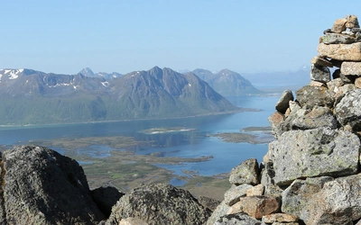
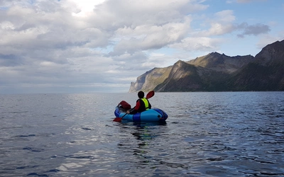
Northern Norway is a land of dramatic contrasts, where the rugged beauty of the Arctic meets the vastness of untouched wilderness. Here we highlight five exceptional multi-day hikes that showcase the region's striking variety, from the jagged peaks of island archipelagos to the expansive tundra of the far north. Whether you're traversing the Lofoten Islands or venturing deep into Inner Troms, these northern vistas are a haven for outdoor enthusiasts, offering an unparalleled sense of freedom and solitude in one of Europe’s most pristine environments.
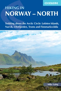
Hiking in Norway - North
Trekking above the Arctic Circle: Lofoten Islands, Narvik, Ofotfjorden, Troms and Finnmarksvidda
£18.95
Guidebook to trekking in Norway above the Arctic Circle, including the Lofoten Islands, the mountains around Narvik and Ofotfjord, Tromso and the Troms region, and Finnmarksvidda in the far north east. Treks range from 48 to 165km in length and take between four and ten days to walk. Includes 1:100,000 maps, itineraries and accommodation guide.
More information
Lofoten Long Crossing
Start: Matmora trail head, Delp
Finish: Vannverk, Sørvågen
Time: 10 days
Distance: 139.2km
Ascent: 6160m
Descent: 6150m
The Lofoten Long Crossing is an unforgettable journey across five of the six main islands of the Lofoten archipelago: Austvågøya, Gimsøya, Vestvågøya, Flakstadøya, and Moskenesøya. This multi-day trek showcases the rugged beauty that has made Lofoten famous, with dramatic peaks, pristine beaches, fjords, and open fjell. Each island has its own distinct character, offering walkers ever-changing views and unique encounters with nature. Spanning mountains, coastal cliffs, and secluded valleys, the trail is a celebration of Norway’s wilderness.
Although parts of the trail are remote and wild, its accessibility and regular opportunities for resupply make it manageable for most hikers. Sections of the route can be tackled independently for those with limited time, with the Ramberg to Sørvågen segment being a popular three-day option. The trail is best walked from mid-June, taking advantage of Lofoten’s temperate maritime climate and long summer days. While the Crossing offers endless opportunities for wild camping, responsible behavior and adherence to local guidelines are essential to preserve the archipelago’s fragile ecosystem.

Mountains of Narvik
Start: Katterat railway station
Finish: Katterat railway station
Time: 5 days
Distance: 76.6km
Ascent: 1685m
Descent: 1685m
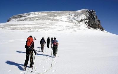
This trail offers walkers an immersive journey into the glacial landscapes of Narvik’s mountainous wilderness. Starting conveniently at Katterat railway station, the first stage swiftly transitions from lush valleys to the rugged embrace of towering peaks. Storsteinsfjellet, the region’s centerpiece at 1893 meters, is encircled by striking summits like Ristačohkka and Rienatčohkka. Despite its prominence, Storsteinsfjellet remains hidden from view for much of the route, lending an air of mystery to the trek.
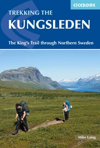
While the main loop is a rewarding challenge, the trail offers opportunities for further exploration. Connections to famed routes like the Kungsleden and Nordkalottruta are within easy reach, or walkers can extend their journey to coastal endpoints like Skjombotn or Beisfjord. Wild camping is abundant, and a network of unserviced DNT huts provides additional options for overnight stays. Best walked from mid-July onwards, when snow has receded from higher passes, this trail offers solitude, breathtaking views, and a glimpse into the Arctic’s pristine ecosystems.

The Mountains of Ofotfjorden
Start: Railway station, Riksgränsen (Sweden)
Finish: Lapphaugen Turiststasjon
Time: 4 days
Distance: 47.4km
Ascent: 1060m
Descent: 1230m
This trail offers a compact yet rewarding journey through the wild landscapes of the Mountains of Ofotfjorden. Traversing the foothills of Bassevárri Rivitind (1452m), the route combines serene fjells, starkly beautiful highlands, and lush valleys, creating a rich and varied hiking experience. With minimal foot traffic, this trail provides a rare opportunity for solitude amidst nature’s grandeur.
Starting near Riksgränsen, the trail ascends to the rugged terrain of Næverfjellet Beassekvárri before descending into the verdant but challenging Bukkedalen valley. The journey continues with a climb to the idyllically situated hut at Slottet, before concluding with a wet and demanding traverse through Stormyra’s valley floor. While the trail offers few facilities, its remote charm and diverse landscapes make it an ideal escape for experienced hikers.

Troms Border Trail
Start: Railway station, Björkliden (Sweden)
Finish: Retkeilykeskus Camping Village, Kilpisjärvi (Finland)
Time: 10 days
Distance: 164.8km
Ascent: 3840m
Descent: 3785m
The Troms Border Trail is an unforgettable expedition through the untouched wilderness of Inner Troms, one of Norway’s last true remote regions. This trail traditionally runs from Innset to Kilpisjávri in Finland, spanning eight days, but starting at Björkliden offers easier access via road and train. It offers hikers awe-inspiring landscapes, from the rugged peaks of Rohkunborri National Park to the bird-rich expanses of Øvre Dividal National Park. Along the way, you might spot traces of predators like wolverines and lynxes, as well as vibrant birdlife, including golden eagles and buzzards. With minimal human interference, the trail provides a chance to disconnect and immerse yourself in nature’s serenity.
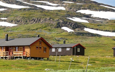
DNT huts are conveniently spaced along the route, providing reliable shelter, while wild camping is also an option for those who prefer solitude. While trail marking is generally good, sections like those between Vuomahytta and Dividalshytta demand careful navigation. With its northern latitude, the trail offers long days of summer light, making it accessible from mid-July, once snow patches have receded. Be prepared for limited transport options to ingress and egress points beyond the start and finish, as well as long stretches without mobile coverage. This trail is a challenging yet rewarding adventure for those seeking an authentic wilderness experience.

Finnmarksvidda
Start: Ássebákti
Finish: Sønvismoen
Time: 5 days
Distance: 114.4km
Ascent: 1660m
Descent: 1755m
The Finnmarksvidda plateau, Norway’s largest at 22,000 km², offers an unparalleled wilderness experience of rolling tundra, vast lakes, and endless skies. Crossing the heart of this subarctic expanse is a remarkable journey into an uninhabited, pristine landscape. The trail is steeped in Sámi culture, with reindeer migrations leaving traces of traditional herding life. Summers bring 24-hour daylight and mild weather, making late June ideal for a visit before the arrival of quad bikes and bothersome mosquitoes in July. The gently rolling terrain makes for fast, rewarding hiking, with huts providing food and accommodation at most stages. Wild camping offers flexibility for those needing shorter days.
This remote trail is rich in wildlife, from Arctic foxes and mountain hares to abundant birdlife such as swans, fjello, and soaring raptors. The plateau’s lakes teem with Arctic char and salmon, attracting keen fishermen. However, its windswept nature means little shelter and limited water sources, so hikers should come prepared to filter drinking water and protect against insects. Transport connections via Alta and Karasjok make the trail accessible, with excellent trail definition and marking ensuring an enjoyable adventure across this awe-inspiring northern wilderness.

