Cycling the Danube: the Black Forest to Budapest
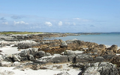
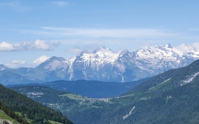
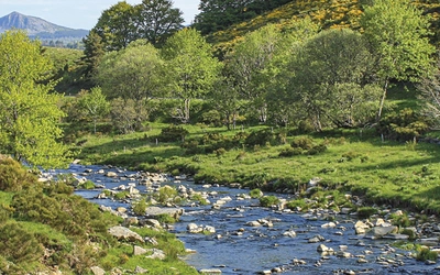
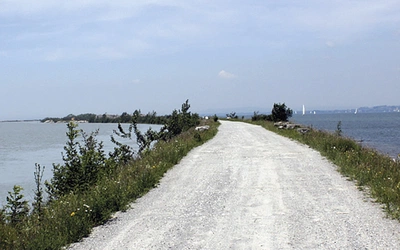
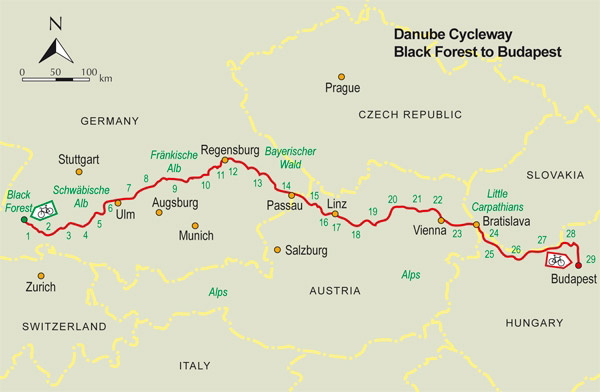
Rising in the German Black Forest, the Danube River runs for 2,772 km through 10 countries on its way to the Black Sea. In this post, we cover all the key facts you need to know about the first half of the Danube Cycleway. This long-distance cycle route runs parallel to the mighty river, passing through Germany, Austria, Slovakia, and Hungary. Along the way, you'll encounter dramatic gorges, hilltop castles, vineyards, medieval towns, and the great imperial cities of Vienna, Bratislava and Budapest.
| What? | The Danube Cycleway |
| Where? | Between the Black Forest and Budapest |
| Is that the entire cycleway? | Only the first part – the first part runs from Budapest to the Black Sea. |
| How long? | 1269km |
| How many stages? | This guide breaks the route down into 29 stages, ranging from 24km to 66.5km. |
| How many countries does this part include? | Four (Germany, Austria, Slovakia and Hungary) |
| Is the route well signposted? | With the exception of Stage 1 above Donaueschingen, which mostly uses the Bregtalweg, the whole route described follows a series of national waymarked cycle routes. These all carry names incorporating some form of words describing Danube cycleway, in the appropriate language. In Germany and Austria, waymarking is almost perfect in its consistency, less so in Slovakia and Hungary, but even here the situation has improved in recent years. |
| How long to complete? | A fit cyclist, covering two stages per day, should be able to complete the trip in a fortnight. |
| Is the route level? | It's downhill (nearly) all the way! |
| When to go? | The route is generally cyclable from April to October. Indeed, much of the route can be cycled at any time of year except for the Black Forest section (Stage 1) where snow can lie until April. |
| How to travel there and back? | The start of the route in the Black Forest (altitude 1094m) is not directly accessible by train. However, Triberg station (617m) is only 12km of fairly easy ascent from the source. |
| What accommodation is available? | For most of the route there is a wide variety of accommodation. |
| What kind of bike do I need? | The most suitable type of cycle is either a touring cycle or a hybrid (a lightweight but strong cross between a touring cycle and a mountain bike with at least 21 gears). There is no advantage in using a mountain bike. |
| What maps do I need? | Freytag & Berndt, Kompass, Public Press and ADFC all publish maps covering most of the route shown in this book. These vary in scale from 1:50,000 to 1:125,000. The only map that includes Stage 1 (Martinskapelle to Donaueschingen) is Kompass RWK 150. |
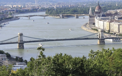
| Route highlights? | Black Forest, Danube sinkholes, Blue lagoon, Ulm cathedral spire (world's highest), Donaudurchbruch gorge, Regensburg medieval altstadt, King Ludwig's Walhalla, Passau, Melk and Klosterneuburg abbeys, Wachau vineyards, Wien (Hofburg, Schönbrunn and Belvedere Palaces, cathedral, Spanish Riding School), Prater Ferris wheel, Bratislava, Esztergom basilica, Danube bend, Budapest (Fishermen's bastion, St Mathias church, Europe's largest synagogue) |
| Stage | Start | Finish | Distance |
|---|---|---|---|
| 1 | Martinskapelle, Bregquelle (1094m) | Donaueschingen, Donauquelle (678m) | 39.5km |
| 2 | Donaueschingen, Donauquelle (678m) | Tuttlingen, Rathausbrücke bridge (645m) | 35.5km |
| 3 | Tuttlingen, Rathausbrücke bridge (645m) | Sigmaringen bridge (571m) | 54.5km |
| 4 | Sigmaringen bridge (571m) | Riedlingen bridge (528m) | 33.5km |
| 5 | Riedlingen bridge (528m) | Ehingen station (509m) | 37.5km |
| 6 | Ehingen station (509m) | Ulm, Metzgerturm tower (471m) | 41.5km |
| 7 | Ulm, Metzgerturm tower (471m) | Lauingen Marktplatz (441m) | 47.5km |
| 8 | Lauingen Marktplatz (441m) | Donauwörth town hall (408m) | 41km |
| 9 | Donauwörth town hall (408m) | Ingolstadt, footbridge (367m) | 59.5km |
| 10 | Ingolstadt, footbridge (367m) | Kelheim quayside (344m) | 50km (45.5km cycling; 4.5km ferry) |
| 11 | Kelheim quayside (344m) | Regensburg, Brückturm (340m) | 37.5km |
| 12 | Regensburg, Brückturm (340m) | Straubing, Theresienplatz (337m) | 53.5km |
| 13 | Straubing, Theresienplatz (337m) | Deggendorf, Hans-Krämer-Strasse (312m) | 39km |
| 14 | Deggendorf, Hans-Krämer-Strasse (312m) | Passau Rathausplatz (301m) | 56.5km |
| 15 | Passau Rathausplatz (301m) | Aschach bridge (264m) | 65km |
| 16 | Aschach bridge (264m) | Urfahr, Nibelungen bridge (254m) | 26.5km |
| 17 | Urfahr, Nibelungen bridge (254m) | Mauthausen, Heindlkai (241m) | 24.5km |
| 18 | Mauthausen, Heindlkai (241m) | Grein ferry ramp (240m) | 39km |
| 19 | Grein ferry ramp (240m) | Melk, Kremser Strasse (209m) | 47km |
| 20 | Melk, Kremser Strasse (209m) | Krems, Bahnhofplatz (200m) | 37.5km |
| 21 | Krems, Bahnhofplatz (200m) | Tulln, Nibelungen monument (175m) | 44.5km |
| 22 | Tulln, Nibelungen monument (175m) | Vienna, Schwedenplatz (164m) | 37km |
| 23 | Vienna, Schwedenplatz (164m) | Petržalka, Nový Most bridge (142m) | 66.5km |
| 24 | Petržalka, Nový Most bridge (142m) | Mosonmagyaróvár, Schloss Óvár castle (122m) | 37km |
| 25 | Mosonmagyaróvár, Schloss Óvár castle (122m) | Győr, Széchenyi tér (120m) | 40.5km |
| 26 | Győr, Széchenyi tér (120m) | Komárom roundabout (113m) | 53km |
| 27 | Komárom roundabout (113m) | Esztergom basilica (109m) | 52.5km |
| 28 | Esztergom basilica (109m) | Szentendre, promenade (105m) | 48km |
| 29 | Szentendre, promenade (105m) | Budapest chain bridge (104m) | 24km |
| Total km | - | - | 1269km |