An introduction to the Sarsen Way
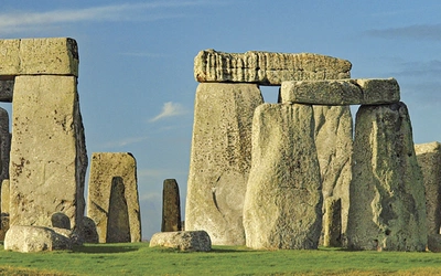
If you're looking for a relatively easy trail to explore over a long weekend, the Sarsen Way is an excellent choice. This 79 km (49 miles) route links two of England's prehistoric sites, Avebury and Stonehenge, while passing by Bronze Age barrows, Iron Age hill forts, and ancient churches along the way. You can expect stunning views, tranquil riverside scenery, charming villages, and welcoming pubs.
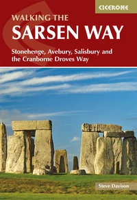
Walking the Sarsen Way
Stonehenge, Avebury, Salisbury and the Cranborne Droves Way
£14.95
Guidebook to the Sarsen Way (79km) from Coate Water Park to Salisbury and the Cranborne Droves Way (28km) connecting Salisbury to Wessex Ridgeway at Win Green. These long-distance paths are part of the Great Chalk Way. Suggested 2-8 day itineraries, OS maps, accommodation options, and reverse route descriptions are included.
More informationEmbark on an unforgettable journey along The Sarsen Way
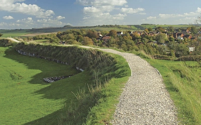
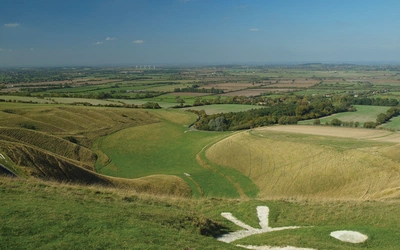
This trail begins at Coate Water Park, on the outskirts of Swindon, and winds through the ancient earthworks of Barbury Castle and along the ancient path of the Ridgeway. For those drawn to the mysteries of the past, optional loops offer opportunities to explore the prehistoric sites around Avebury, Durrington, and the iconic Stonehenge.
The route meanders through the tranquil Vale of Pewsey and runs alongside the peaceful Kennet and Avon Canal, before skirting the edges of Salisbury Plain. The final section of the Way continues southward, passing the impressive earthworks of Old Sarum, and concludes at the magnificent Salisbury Cathedral.
How hard is the Sarsen Way?
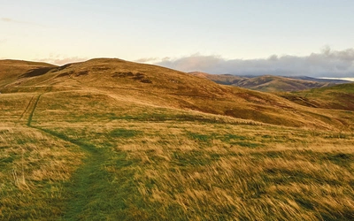
The Sarsen Way covers relatively gentle terrain, with each stage featuring less than 260 meters of ascent. This makes it suitable for people of all ages and abilities. However, be aware that the trail can be muddy during winter, and some road crossings, as well as sections along quiet country roads and lanes, require extra caution. The trail typically takes about four days to complete, but it can be shortened or extended based on your schedule and fitness level.
You can walk the route at any time of the year, although walking between early spring and late autumn generally offers more stable weather and better walking conditions. Periods of wet weather can make parts of the route (especially the Cranborne Droves Way) muddy in places.
Can I use public transport to travel to and from the route?
Getting to Coate Water Park for the start of the Sarsen Way is easy by rail or road. The nearest mainline train station is Swindon, on the line from London Paddington to the south-west and south Wales. Local buses operate daily between Swindon town centre and Coate Water Country Park (east-bound stop) or Chiseldon. National Express coaches running between London Victoria and Bath stop at Coate Water.
At Salisbury, there are rail services on the line between London Waterloo and the south-west. National Express bus services operate to London. For anyone wishing to drive, parking (either in a car park or on the street) is available near the start and end of each stage.
The Sarsen Way and the Cranborne Droves Way
The Sarsen Way has been developed by The Friends of The Ridgeway, a registered charity that has campaigned for over 40 years to preserve the unique character of the ancient ‘ridgeway’ tracks that form the Great Chalk Way across Southern England, including The Ridgeway National Trail. The route of the Sarsen Way follows parts of three existing long-distance routes; the Ridgeway from Barbury Castle to Overton Hill; the White Horse Trail across the Vale of Pewsey; and the Pewsey Avon Trail from Manningford Abbots to Salisbury.
The Cranborne Droves Way is a 28km route linking the end of the Sarsen Way at Salisbury to the Wessex Ridgeway at Win Green. An optionalending at Shaftesbury, that is not partof the Cranborne Droves Way, is alsodescribed. The Cranborne Droves Way consists of an amalgamation of three ancient routes: the Old Shaftesbury Drove; the Ox Drove; and Akling Dyke, a former Roman road. Like the Sarsen Way, the Cranborne Droves Way passes over comparatively gentle terrain, each stage having less than 330m of ascent.